That position has exposed the peninsula to trade, conquest, migration and the circulation of skills. Each route led towards a different set of partners. A city on the upper Adriatic could depend on the opposite shore; a Ligurian town on links across the Tyrrhenian Sea; an Alpine community on mountain passes rather than on Rome. For centuries, no single centre could steadily organise the entire peninsula. There were networks of towns, courts, ports, farming districts and valleys, each tied to its own sphere of relations. Geography does not explain everything, but many Italian differences become harder to read without it. [2]
A folded country
Italy’s length matters, yet the distribution of usable land matters more. In the 2025 Italian Statistical Yearbook, with figures for 2024, ISTAT reports that 41.6 per cent of the national surface is hilly, 35.2 per cent mountainous and only 23.2 per cent flat. Nearly three quarters of the country therefore consists of slopes, uplands, basins and valleys. Plains certainly exist, and some are broad and densely settled, but Italy has no single, continuous interior plain of the kind found elsewhere in Europe. [1]
This terrain influenced where people settled. Communities concentrated in valley floors, intermontane basins, defensible hills, river mouths, coastal strips and limited plains. Each setting offered a different mix of water, arable land, pasture, timber and access to a road or a harbour. Crossing one ridge could change exposure to sunlight, soil quality, crops and available connections. In some mountain areas, a valley once communicated more easily with what is now another country than with its regional capital. Italy was divided as much by the practical difficulty of moving through it as by political borders. [1]
Alps and passes
The Alps marked Italy’s northern edge, but they were never an impenetrable wall. Snow, ice, steep slopes, gorges and short travelling seasons imposed serious limits. At the same time, the passes channelled merchants, pilgrims, soldiers, craftspeople, seasonal workers and families on the move. Mountains channelled contact along recognised routes that were expensive to maintain. Treccani describes the Alpine arc as a historical frontier between Latin, Germanic and Slavic cultural areas. [3]
This double role helps to explain regions often treated as margins. Aosta Valley, Trentino-Alto Adige, Friuli-Venezia Giulia and Liguria have long been contact zones, linked to neighbouring states, cross-border markets, minority languages and different administrative traditions. Their histories can still be heard in speech, seen in buildings and recognised in farming systems. They remain living evidence of how territories with strong outward contacts built their own characters. They show how territories with strong outward connections became part of a state that was politically unified only in the nineteenth century. [3]
The backbone
While the Alps define the northern boundary, the Apennines run through Italy. The chain stretches from Liguria to Calabria, changing height and form, widening into massifs, breaking into basins and leaving room for passes and ravines. Its effects varied sharply from one valley to the next. In some places valleys encouraged movement and exchange; elsewhere, a short crossing demanded a long detour, a seasonal pass or a road exposed to landslides and snow. [4]
The Apennines made travel between the Tyrrhenian and Adriatic sides especially demanding. Two towns on nearly the same latitude could belong to different economic and political circuits. The Marche offer a clear example: between the mountains and the Adriatic there are few large plains, and routes depend on gorges, passes and gaps in the relief. Traders, armies and pilgrims still crossed these areas, but time, cost and risk were different. In Italy, a few kilometres and a mountain in between could alter pronunciation, market goods, property relations and commercial partners. [4]
The great plain
The Po Valley is the major exception within a country of hills and mountains. Treccani describes it as Italy’s largest plain, a coherent geomorphological and hydrographic area bounded by the Alps to the north and the northern Apennines to the south. Including the Venetian plain, it covers roughly 46,000 square kilometres, just under one sixth of Italy’s surface. [5]
It should not be used as a shortcut for every economic difference between north and south. Industrial history also depends on capital, education, public investment, institutions, international trade and labour. Yet the plain offered some practical advantages: plentiful water, continuous farmland, closely spaced cities, rivers and canals, and room for roads and railways. The Po, land reclamation, rice fields, wetlands and irrigation systems produced varied local economies. Geography opened possibilities; it did not assign a destiny. [5]
Different seas
The Mediterranean is far more than a blue backdrop to the peninsula. For many periods, the sea was a faster and cheaper route than inland roads, especially for heavy goods such as grain, timber, wine, oil and textiles. Navigation had its own dangers: seasons, winds, available harbours, secure routes and political control of the coast all mattered. Still, a ship could connect distant towns more readily than a cart crossing ridges, rivers and poorly maintained valley roads. [7]
Each Italian sea opened towards different worlds. The Tyrrhenian faced Corsica, Sardinia, Mediterranean France, the Iberian Peninsula and the western basin; the Adriatic fostered relations with the Balkans, Greece and the Levant; the Ionian Sea and the Strait of Sicily connected southern Italy with the eastern Mediterranean and North Africa. Amalfi, Pisa, Genoa and Venice built much of their political and commercial strength on maritime activity. The sea linked Italy to the world, though the connections it created followed uneven paths. [6]
Cities and routes
A port city and an inland city could become important for very different reasons. Venice grew from the lagoon and from Adriatic and Mediterranean relations; Bologna benefited from its position between the plain, the Apennines and land routes; Genoa faced a narrow coast backed by Ligurian mountains; Turin developed through its links with the plain and western passes. Naples had a harbour able to attract people and goods, while L’Aquila built urban life in an Apennine basin along inland routes and transhumance paths. [6]
These differences can be read in urban form. Ports depend on quays, arsenals, warehouses, shipyards, commercial quarters and foreign merchant communities. Inland cities may draw strength from regional markets, rivers, administrative functions, universities, fairs and control of surrounding farmland. Italy’s urban map is less a pyramid with one summit than a network of centres that have grown and declined at different times. Physical proximity was no guarantee of frequent relations: Genoa could have closer commercial ties with overseas cities than with parts of its own hinterland. [7]
Real distances
Saying that internal communication was difficult left room for considerable mobility. Roman roads endured for centuries; medieval merchants crossed the peninsula; pilgrims followed the Via Francigena and many other routes. The issue was continuity. Roads and bridges needed maintenance, rivers could interrupt passage, landslides closed routes, and snow made some passes seasonal. Political borders, tolls, local wars and banditry added further costs. [7]
For travellers on land, the price of a journey depended on road quality and safety. A neighbouring Apennine valley could be only a few kilometres away and yet functionally farther than a town reached by boat. That helps explain the historical weight of coasts and rivers. The question remains current in another form. ISTAT defines inland areas by their distance from centres providing health, education and mobility services, calculated through actual road travel times. Distance is still measured in the minutes needed to reach a hospital, a secondary school or a station. [8]
Geography on the table
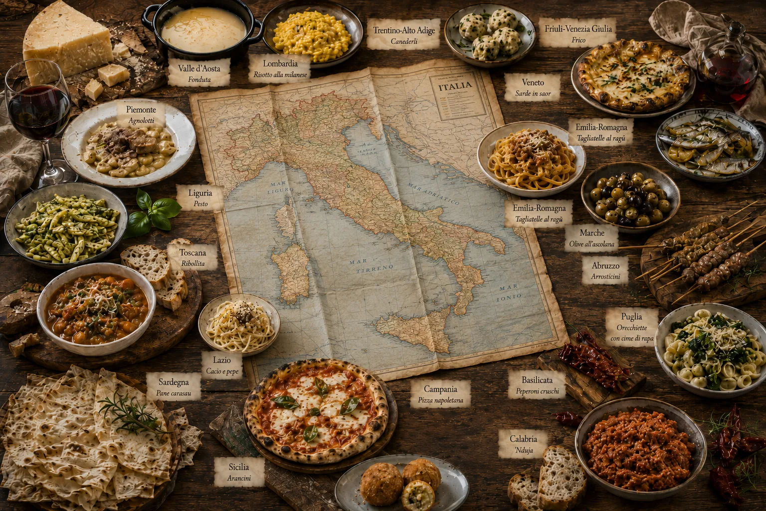
Italian food entered this story long before a national cuisine was imagined. Climate, altitude, water, soils, livestock, access to the sea, trade networks and the ability to preserve food shaped local repertoires. Butter became more common in many plains and mountain areas where cattle farming was widespread; olive oil followed the zones suited to olive cultivation. Rice, maize, dried pasta, fresh pasta, Alpine cheeses, pulses, citrus fruit and preserved fish all reflect both material conditions and exchange. [10]
It would be too simple to say that mountains produce polenta and the sea produces fish. Food also follows trade. Sicily absorbed ingredients, methods and tastes arriving through the Mediterranean; northern cities adapted products that came from other continents; inland areas developed dishes based on preservation, cereals, grazing and seasonal movement. Treccani notes that recipe books, guides and cultural policies helped assemble traditions that had once been more narrowly local. UNESCO, meanwhile, describes the Mediterranean diet as a social practice connected with hospitality, neighbourliness and dialogue. [9][12]
Local voices
Italy’s linguistic differences offer another clue to its territorial complexity. Dialects, regional languages, local speech and accents are sister languages in their own right. Many have long histories and their own structures, shaped by Latin, neighbouring languages, trade, migration and the cultural authority of particular cities. Literary Florentine became the basis of standard Italian, but broad social diffusion came much later through schooling, administration, military service, radio, television and internal mobility. [11]
Treccani notes that the vernaculars of the peninsula had already diverged markedly between the north and the centre-south in the Middle Ages, while the political geography of the old Italian states reinforced different written and spoken usages. Mountains and islands often helped local features persist; sea routes introduced new words and influences; commercial cities spread forms beyond their immediate surroundings. Geography never acted alone, but it slowed some movements, enabled others and helped communities keep recognisable voices. [11]
Unequal chances
The relationship between geography and the economy calls for restraint. Fertile plains, ports, navigable rivers, passes, dense cities and proximity to European markets have all offered concrete advantages. Yet none of these features automatically turns an area into a prosperous one. Institutions, investment, education, work, infrastructure and public choices matter. A harbour can remain marginal, a plain can be marked by inequality, and a border town can lose its function when trade routes change. [1]
Italy also resists a rigid north-south contrast. There are dynamic coasts and struggling coasts, industrial districts in hilly territory, flat areas marked by social fragility, internationally connected islands and inland towns that struggle to retain services. In 2024, municipalities with no more than 5,000 inhabitants numbered 5,523, or 69.9 per cent of the national total. They covered 54.9 per cent of Italy’s territory but housed 16.4 per cent of its population. Their needs differ, but many face the same task: keeping services and connections available to scattered communities. [1]
Contemporary times
Motorways, railways, airports, low-cost flights, the internet and internal migration have brought parts of Italy closer that once knew little of one another. Someone may work in Milan and speak daily with family in Sicily; a local recipe can travel across social media within hours; students and workers cross regions their grandparents rarely saw. Physical distance has lost some of its force, though not all of it. [1]
Mountain, island and inland areas still experience time differently. Reaching a hospital, school, university or workplace depends on the quality of networks, the frequency of transport and the shape of the land. Italy has been united by geography because seas, plains, cities and trade routes put distant territories in contact. The same geography made those relations uneven, costly and intermittent. That is why the country still contains, in a single day, an international port, an isolated valley, a large urban plain and a small municipality far from essential services. [8][1]
Sources
Discussion
Join discussion!
There are already 0 comments on this article in the forum.