There is no fixed Neapolitan character. There are urban habits, social relationships, ways of speaking, family memories and ways of using space, all formed over centuries of history. Geography enters that history because it sets material conditions: where building is possible, how people move, what land can be cultivated, how close the port is, and which parts of the city remain exposed to the sea or to the hills. Naples occupies a relatively small municipal area, just over 119 square kilometres, yet its coastline, hills and volcanic surfaces make it highly varied. [1]
Within the Gulf
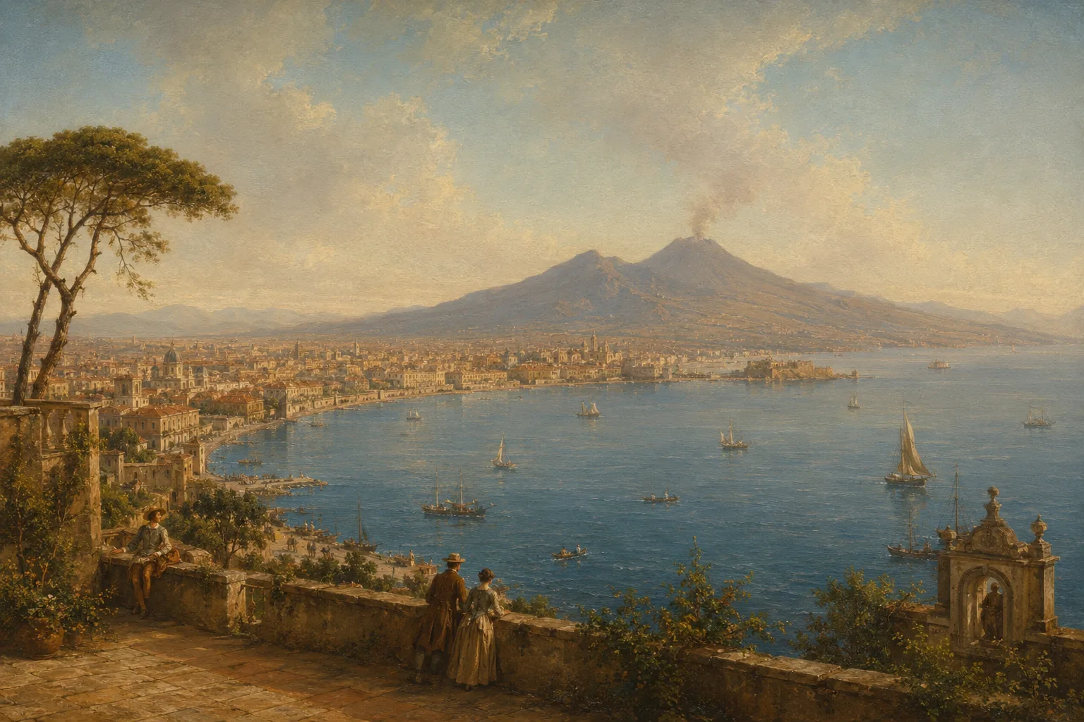
Naples is more than a coastal city. It sits within a gulf, and that word “within” matters. The Gulf of Naples links the city with Vesuvius, the Sorrentine Peninsula, Capri, Ischia, Procida, Pozzuoli and the Campi Flegrei. The sea does not appear at the end of the streets as a distant edge: it enters city life through the port, quays, ferries, fishing, wind, light and a shoreline that changes sharply from one neighbourhood to another.
This position has long encouraged contact with the Mediterranean. Naples has been a trading port, a political capital, a military city and a point of passage for people from the peninsula, the islands, Europe and the other shores of the sea. UNESCO describes its historic centre as that of a major port city at the heart of the ancient Mediterranean. Its urban history still preserves the relationship between the built city and the gulf around it. [5] Naples looks towards Vesuvius, but Vesuvius also looks down on a metropolis, a port and a territorial system far larger than the city’s administrative boundaries.
Two volcanic systems
Vesuvius is not scenery. It is an active volcano south-east of Naples, part of the Somma-Vesuvius complex. The eruption of AD 79 destroyed Pompeii, Herculaneum, Stabiae and Oplontis; the most recent eruption took place in 1944. Since then the volcano has been in a state of quiescence, observed and monitored by scientific bodies and Civil Protection. [2] Its presence has created a long memory: archaeology, family stories, school images, postcards, photographs and emergency plans all belong to the same territorial experience.
To the west of the city lies another geological reality, often left in the background by more conventional accounts: the Campi Flegrei. This vast volcanic caldera stretches from Monte di Procida to Posillipo and includes a submerged sector in the Gulf of Pozzuoli. Here bradyseism, the slow uplift or subsidence of the ground linked to the workings of the volcanic system, has tangible effects on urban life, homes, services and infrastructure. [3] To speak of Naples is therefore to speak of a city between two volcanic systems with different structures and histories, rather than the cliché of a city “at the foot of Vesuvius”.
Cultivated ground
Volcanic matter has also shaped agriculture. Saying simply that a volcano “destroys and makes the earth fertile” erases human labour, farming practices, water availability, climate and the proximity of urban markets. Land around Vesuvius, the commercial pull of a large city and transport networks have supported market gardening, vineyards, orchards and products with a strong local identity.
The Pomodorino del Piennolo del Vesuvio DOP makes that connection visible. Its production specification links the product’s character to the agronomic conditions of the Vesuvian area and to preservation methods that allow the bunches of tomatoes to keep for months after harvest. [4] Alongside them are Vesuvian apricots, vineyards producing Lacryma Christi, crops from the Campi Flegrei and citrus fruit from the Sorrentine Peninsula. Local cooking also grew from this closeness: a large city, numerous markets and countryside near enough to supply fresh, preserved or processed produce.
Port and Mediterranean
Naples belonged to the Mediterranean before it belonged to Italy. Its position connected it with Sicily, Spain, France, the Levant, North Africa and the other cities of the peninsula. Goods entering the port carried techniques, ingredients, languages and commercial habits with them. The sea moved grain, wine, oil, textiles, ceramics, people, news and political power. The city’s history cannot therefore be reduced to a southern story enclosed within national borders.
The historic centre retains traces of these layers: Greek and Roman layouts, fortifications, convents, palaces, markets and streets created in different periods. UNESCO notes that the site reflects the city’s long history and that its value also depends on its position in the bay. [5] The port was never merely a gateway outwards. It shaped occupations, neighbourhoods, work flows and urban boundaries. Naples by the sea is not just a promenade view: it includes warehouses, piers, services, ferries, stations, customs offices, industrial activity and daily ties with the islands and the entire gulf.
A city on slopes
Naples did not grow across a broad, level plain. Coastline, hills, hollows, slopes and changes in elevation demand more complicated routes. Stairs, stepped streets, ramps, climbs, viewpoints, lifts and funicular railways are practical answers to difficult topography. A journey from the port to Vomero changes more than altitude: it changes air, outlook, access to services, the relationship with traffic and distance from the sea. That is also why districts such as Chiaia, Sanità, Quartieri Spagnoli, Posillipo, Vomero, Fuorigrotta, Barra and Ponticelli produce very different urban experiences.
Vertical mobility entered the city’s history between the nineteenth and twentieth centuries. The Chiaia and Montesanto funiculars opened between 1889 and 1901; today the network also includes the Centrale and Mergellina lines. [6] They are not picturesque details but tools linking areas at different heights. Verticality affects travel time, accessibility, property values and the organisation of services. In a city built on slopes, every change in elevation can become a social distance as well as a physical one.
Density and proximity
Naples is often described as crowded in a folkloric way, almost as though crowding were a natural trait of its people. Urban density is a material condition instead. According to Istat, in 2021 the Metropolitan City of Naples had the highest density among Italy’s metropolitan cities: 2,535 inhabitants per square kilometre. In the municipality alone, the figure exceeded 7,700 inhabitants per square kilometre. [7] Figures of that kind help explain the weight of housing quality, mobility, maintenance of public spaces and the availability of services.
Street, balcony, courtyard, bar, market and bench take on particular importance where private space is often limited and public space is shared by many people. This closeness can create networks of acquaintance, mutual help, conflict, noise and pressure on buildings. Density guarantees neither vitality nor decline: outcomes depend on housing policy, transport, household income, the quality of schools and the distribution of services. To talk about “street life” without those conditions is to describe the effect while ignoring the causes.
A changed coastline
Naples does not stand before a free and uniform stretch of sea. The relationship between city and coast has been altered by the port, industrial zones, land reclamation, infrastructure and building growth. The municipality’s strategic document notes that the urban shoreline was profoundly reshaped during the twentieth century and that industrial or logistical use has, in several areas, interrupted continuity between neighbourhoods and the sea. [8]
This history does not call for nostalgia. Port and industry have created work, connections, skills and economic activity. They have also built barriers, separations and spaces removed from everyday use. Bagnoli, the eastern area, the commercial port and several stretches of coastline reveal different relations with the sea. Posillipo offers descents, coves and fragmented access; the waterfront along Via Caracciolo places the sea at the centre of the city’s public image; other parts of Naples encounter it mainly as infrastructure, work or boundary. The sea connects Naples to the world, yet it is not distributed equally in the lives of all its residents.
Risk and inequality
Volcanic risk is neither a test of individual courage nor local colour. It requires monitoring, planning, public information and the capacity to organise evacuations, transport and assistance. For Vesuvius, Civil Protection has designated a red zone for preventive evacuation should eruptive activity resume; it covers 25 municipalities in the provinces of Naples and Salerno, as well as parts of the municipality of Naples. [9]
Natural risk and social risk remain distinct, yet they can overlap. An earthquake, a bradyseismic crisis or a volcanic emergency affects people differently according to building quality, neighbourhood density, household income, transport efficiency and trust in institutions. National planning for the Campi Flegrei takes account of the need to connect scientific knowledge with territorial organisation. [11] To portray Naples as fatalistic in the face of danger is a simplification. People living in exposed areas have to deal with information, alerts, work on buildings, public decisions and the pace of administration.
Cuisine of place
Neapolitan cooking grew from a concrete combination of port, markets, nearby farming, cereals, dairy products, fish, vegetables and urban growth. Pizza and tomatoes are central to that story, but they cannot consume all the rest. Naples has popular, bourgeois, convent, aristocratic and street cooking; cooking of the sea and of the inland; a tradition of preserves, fried foods, pasta, sweets and dishes able to feed many people with accessible ingredients.
Pizza shows the relationship between city and territory particularly clearly. Its modern form developed in an urban setting dense with ovens, shops, markets and workers, yet it uses products arriving from rural areas and regional supply chains. In recognising the art of the Neapolitan pizzaiuolo, UNESCO focuses on knowledge of dough, shaping, baking and transmission of the practice. [10] Geography does not explain a recipe on its own; it explains why city, port, agriculture, ovens and trade were able to meet in the same space.
More than one Naples
There is a Naples of the gulf and another that barely sees it. There is a Naples built on the hills and another living among infrastructure, railway lines and industrial coast. There is the Naples of historic-centre alleyways, that of western districts near the Campi Flegrei, that of the eastern area facing Vesuvius and that of suburbs created during the great expansions of the twentieth century. Each part of the city has a different relationship with the sea, slope, work, risk and access to services.
This makes any single portrait of the city of little use. Naples has more than one geography and therefore produces more than one Neapolitan experience. Vesuvius, the port and density are part of its visual identity, but daily life differs greatly by neighbourhood, age, work, income and freedom of movement. Geography helps us read those differences without turning them into fate. When a volcano becomes a tourist symbol, a coastline becomes a view and an alleyway becomes a social-media image, people who inhabit those places every day can disappear from sight.
A city to explain
Naples is not “like this” by nature. The sea does not automatically create openness, the volcano does not produce fatalism and density alone does not create sociability or conflict. Political history, inequality, migration, planning choices, work and public services explain a decisive part of the city. Easy formulas erase precisely those elements.
Without the gulf, the port, the hills, the Campi Flegrei, Vesuvius and the high concentration of people, many passages in Naples’s history would remain obscure. The city has had to learn to live with elevation changes, with the sea as resource and boundary, with generous yet vulnerable land, and with a natural risk that demands knowledge and organisation. Anyone travelling between the port and a hill, a market and a funicular, the waterfront and an inland district still encounters this concrete geography today.
Bibliography
Discussion
Join discussion!
There are already 0 comments on this article in the forum.